Monday 18th August
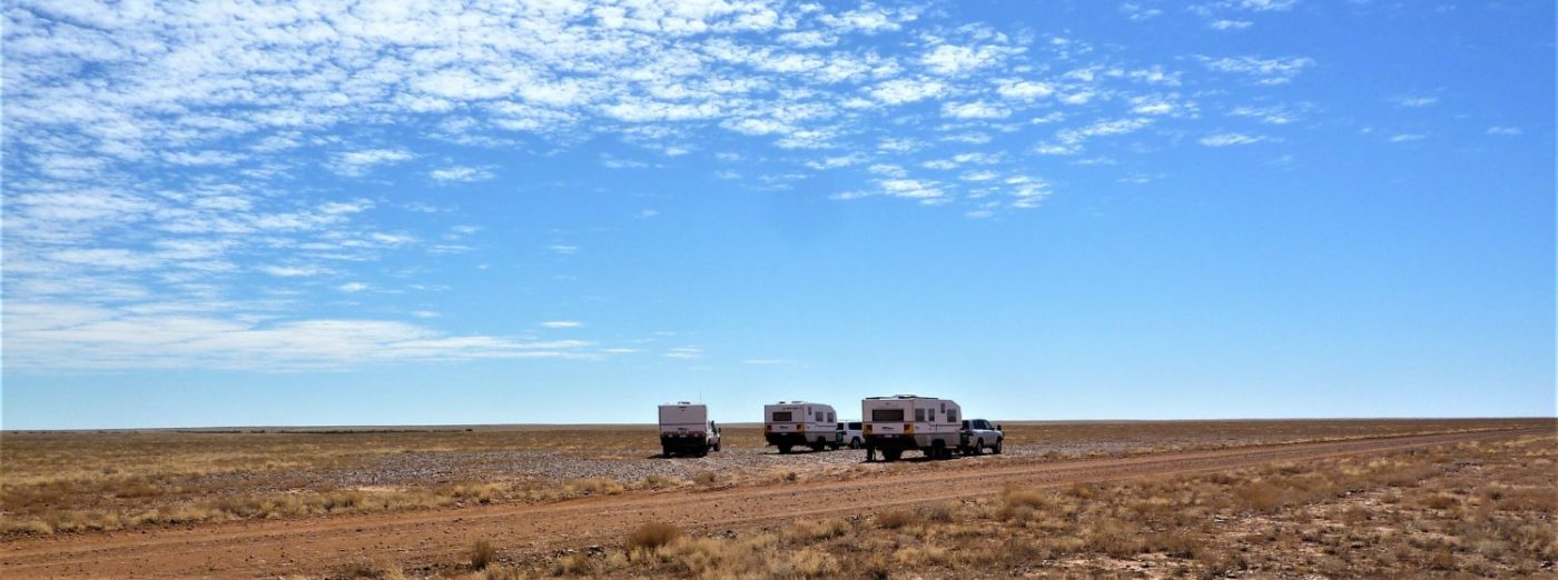
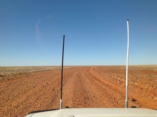
After a good meal last night we have an earlyish start and head back into the landscape on our way to Dalhousie Springs. As I mentioned we are really in the western regions of the Simpson Desert which, past Dalhousie becomes a series of sandunes virtually all the way to Birdsville. I think there are nearly a thousand of them, the average height being 12–15 metres, which obviously precludes taking a caravan with you but some do tow campers trailers although these tend to make the climbing the sand dunes more difficult and can result in damage to the track.

 Hmm, morning tea might be a good idea…..
It is only 73 ks to Dalhousie but it takes us 3.5 hours including morning tea, we have to drive to the conditions and our speed ranges from 10 to about 35 kph.
When we get to Dalhousie we decide to stay here tonight, the prospect of an afternoon relaxing in the swim in the hot springs is pretty compelling. As it happens, I have to spend an hour bolting down the water pumps, which have vibrated loose on their mountings.
Eventually I make down to the springs where the others have been relaxing for a while.
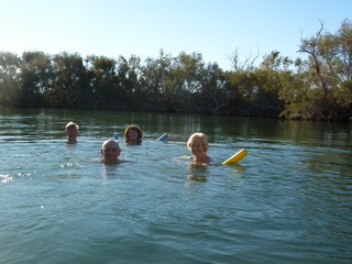 So here we are on the edge of the desert, having travelled through the gibber plains and the sand dunes, having a relaxing swim in water around 35 deg C, fed by artesian water at 43 deg C.
It has been a very demanding drive and a bit of R & R is very welcome.
Tuesday 19th August
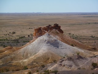
Seven ks down the track from the Springs are the ruins of Dalhousie Homestead, which was built in 1872 on a 100 sq mile property, with the intention of growing grain because when it was surveyed there had been a couple of wet periods and everywhere was green. However, this did not last and very soon it was obviously not going to be growing grain and they started running sheep and cattle, it kept going until the depression when, it was wound up. The story of the owners is, like many of these stories, one of extreme hardship and privation for very little return.
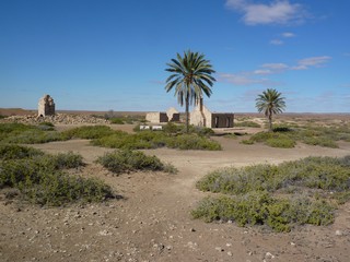
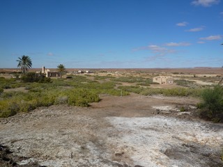
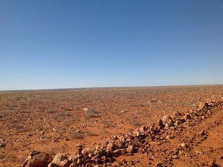
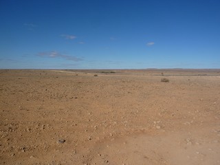
The backdrop to the ruins gives some idea of the country that surrounded this property.
Not far down the track is a bit of a lookout which again shows the country around here.
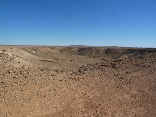
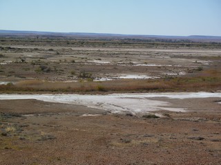
Pretty inhospitable. We are heading for Hamilton Station and then Oodnadatta and the countryside remains pretty harsh for the next 100 or so clicks.
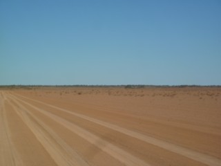
It is slow going again, down to 15 kph for long stretches, the corrugations are virtually continuous, you cannot take your eyes off the track for a second because holes full of powdery sand (bulldust) and ruts appear out of nowhere.
After Hamilton Stn the road is suddenly brilliant for a few ks, unfortunately it doesn’t last and we’re back into the corrugations again, although nowhere near as bad as they have been.
We’re not going to get to Oodnadatta tonight so we pull off the track and settle in for a glass of red and ‘skywatch’. One of the real paybacks for the hard travelling are the night skies, tonight there is no cloud and we’re sitting under a hemisphere of stars, there is no pollution so everything is crystal clear. The ritual has become that we don’t go inside until we have spotted one particular satellite which crosses us from west to east each evening. The nights are still very cold out here, down to 3 deg, so we’re sitting in our coats and beanies searching for the satellite and any passing meteors.
Wednesday 20th August
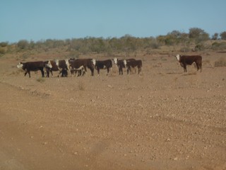
This morning we have an 0830 start and set out for Oodnadatta and Arkaringa. One bit of excitement is where the track crosses a claypan, the road is suddenly smooth for a few hundred metres and we can at last go a bit faster but only for a short time as a group of bovines provide a potential hazard.
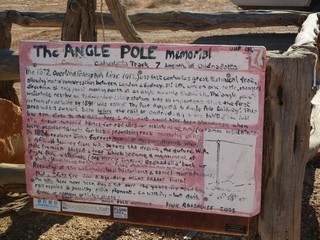
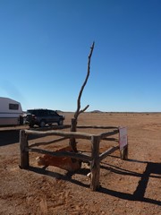
A few ks down the track we stop to have a look at the Angle Pole Memorial, strangely this old pole has quite a significant place in history. It was where the Overland Telegraph Line (OTL) changed direction, which required some additional support hence the ‘angle pole’. Someone has stolen the porcelain insulator from the top of the pole, of course.
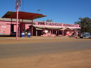
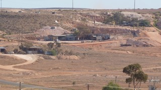
The road gradually improves and then we’re in Oodnadatta another iconic outback Australian township, sadly, like Finke it is really a tip. The Pink Roadhouse is an outback institution and we stop to have a look round, unfortunately it’s nowhere near lunch time so we don’t have an excuse for a burger.
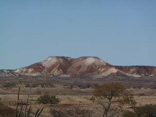
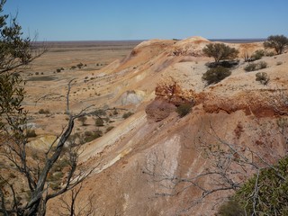
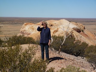
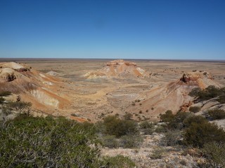
About 80 ks south of Oodnadatta we turn off the track and head for Arkaringa, arriving at the Painted Desert at lunchtime.
The Painted Desert is so named because of the colourful rocks. The colours are produced by the many and varied minerals in the rocks that have been leached out by thousands of years of rain and wind. Pat and I came here two years ago but Pete and Loraine have not been here before.
It’s only a few ks to Arkaringa Station where we are stopping tonight. They have just finished mustering when arrive and we have a chat with ‘Whitey’ from Mt Barry Station and a couple of mates who try to persuade us to go to the Bronco Branding at William Creek on Friday night. Sadly we’re not heading in that direction but can imagine what it will be like in the William Creek pub!
We’re here early, so we have time for a shower before settling down for the satellite spotting session – we see three again tonight, in one of the biggest night skies of the trip so far.
Thursday 21st August
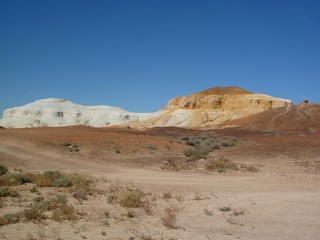
A leisurely start this morning as we have a short run into Coober Pedy, we go via ‘The Breakaways’ a different version of the Painted Desert and possible more colourful. Again Pat and I were here two years ago when we came out in the evening to watch the sun go down over the jump-ups and the changing colours, which were impressive.
And so out onto the Stuart Hwy and some easy driving at the end of six days of fairly hard driving on some pretty rough roads.
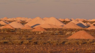
The proximity of the opal mining town of Coober Pedy is well defined by the thousands of mullock heaps and underground houses.
Friday 22nd August
We have a bit of shopping to do today, in particular we want an Australian (the newspaper) as we have been going cold turkey on the cryptic for nearly a fortnight! We managed to get yesterday’s which is pretty good.
We’ve been here before and done the tourist bit so decided to have a quiet afternoon but by the time I’ve regreased the caravan coupling, pumped the tyres back up (since we’ll be on the tar for a while now), cooked a load of chicken legs in the camp kitchen, most of the afternoon gone!
Peter and Loraine are back so it’s time for a glass of red and watch the sun go down but we are out to dinner tonight because this is the last opportunity for a decent mal together befor w go our separate ways on Sunday morning.
Saturday 23rd August
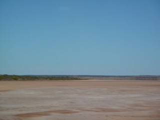
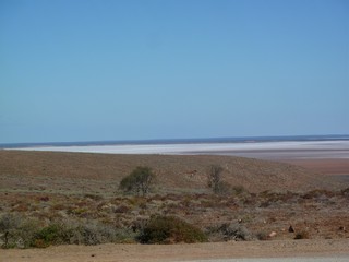
We leave in good time this morning, we have nearly 400 ks to do today as Woomera is the destination. Once we are 50 or 60 ks south of Coober Pedy, the mines peter out and we are in very empty country, we’re crossing the flight path of the experimental rockets that were launched from Woomera in the 50s and 60s, this flight path extends into northern Western Australia. There are very few features in this landscape but there are salt lakes to both sides of the highway and occasionally a large claypan.
Just after our lunch stop we arrive at Spud’s roadhouse which marks the Woomera turn-off, this is also the road to Roxby Downs (90 ks up the the road), a mining town which supports the Olympic Dam mine site, a huge complex, where iron ore, copper and nickel are mined and processed on one huge site.
There is an ore train waiting just north of the road crossing and Pat tries to get a photo of it but has trouble getting it all in shot.
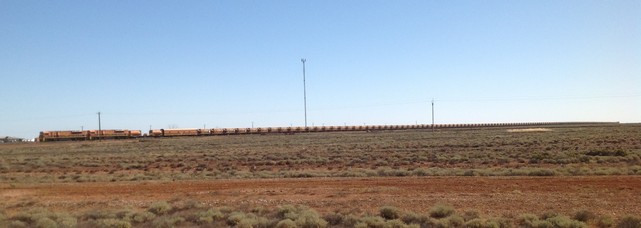
This train is probably 1.5ks long, two engines up front and one at the back.
Pat and I are only going as far as Woomera but Pete and Loraine are going to Roxby on their way back to Sydney.
Woomera was the place where most of the UK’s rocketry was tested in the 50s, 60s and 70s, a project initiated by Churchill in 1944 following the use of V2 rockets by Germany. The site was located, surveyed and laid out by Len Beadell who later went on to build some of the most remote roads through central Australia. As you drive up to Woomera it is clearly a military establishment, the rows of quarters and singly accommodation are typical. The camp site is just to the north of the military camp but is within walking distance and once set up we all walk into ‘town’, past the open air museum, containing the rockets and other equipment associated with the base.
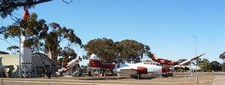
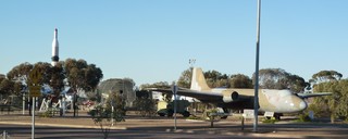
The aircraft on the right is a Canberra PR (photo reconnaissance) Mk?, I worked on these in the RAF and the one on the left is a Meteor Mk7, the lifex engines from these aircraft,
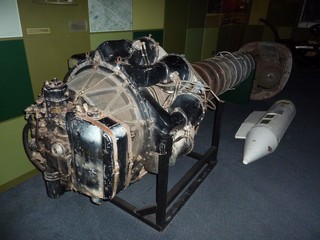 Were used to blow snow off the runways – ever do snow blowing duty Kenny?
The indoor museum itself was the fascinating story of, the construction and operation of this remote base (200ks north of Pt Augusta with nothing in between), its development as a town in its own right in the heady years of the 50s, 60s and 70s and its considerable contribution to the develoment of all aspects of rocketry. It is still operational for testing equipment but at the moment it is quite a sad place.
Three satellites again tonight but no meteors.
Sunday 24th August
We say goodbye to Peter and Loraine this morning, with a tentative plan to meet up in 2016 for a trip into Kakadu and NW WA, we have enjoyed their company and appreciated the safety factor of having an exprienced outback traveller with us. They have about three weeks to make their way back to Sydney.
We head south back on the Stuart Hwy and have covered about 60 ks when we are aware of an unusual noise, we stop to find that we have a blowout in the rear nearside caravan tyre, which has basically disintegrated and ruined the rim.
It takes about 45 mins to change the wheel and check everything out before getting back on the road, we are in no hurry so the time lost matters little.
Once again we are travelling through some very remote country, even though we are on the main highway.
We reach Pt Augusta and join the Eyre Hwy which is really the road home for nearly 2000ks to Norseman. We have covered a fair distance today and are looking for a nice quiet spot for this evening’s camp site. Pat has located a place which is about 3ks off the highway which sounds ideal, Tcharkuldu Hill behind a little hamlet called Minipa, which turns out to be a very good place to stop. The ‘hill’ is worth a walk as the sun goes down and gives extensive views over the otherwise pretty flat landscape.
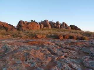
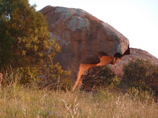
The ‘hill’ is comprised of red sandstones that have been eroded by water, wind and sun which has created some interesting shapes, we thought ‘sabre toothed tiger’ for one!
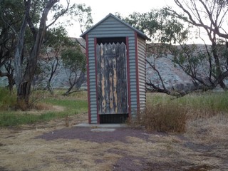 The dunny was a classic and still in use.
We have our quiet night.
