A few travel restrictions have temporarily constrained our usual winter expedition to warmer climes so we decided on a short change of scenery. We can now head north but with the school holidays coming up we will delay our departure until the numbers have calmed down a bit.
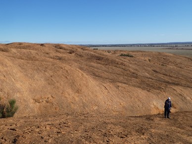
The wheatbelt has a lot of granite outcrops, some around 150′ amsl and as well as providing homes for animals and birds, many have provided a water source for aboriginals and in the last 150 years for the settlers who came to farm these lands.
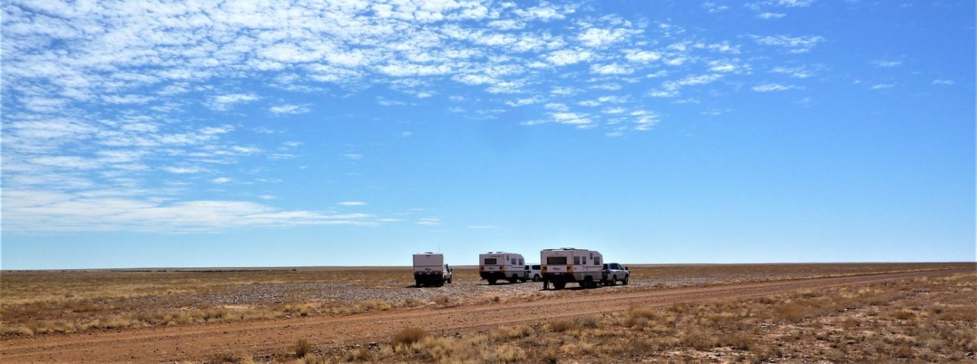
 We have planned to meet Richard and Marge at Baladjie Rock on Tuesday, however, we decided to leave on Sunday and take our time getting there. We actually got away close to the planned ETA in spite of the rain which had persisted for a few days prior to our departure.
As an aside, we had been using quite a lot of firewood over the last few weeks because of the cold damp days, (we are not usually here at this time of year) and I have had to do a bit of tree felling to stock up as the logs need to dry for two years.
We stayed the first night at Kulin, it was a bit colder than down on the coast but not too bad. On the following night we stopped at Bruce Rock and although it was a really beautiful day, at night it was a bit colder!
On Tuesday we had an easy run up to Baladjie and arrived around lunchtime. There was one other van there and we met the owner, whose name was Bob. he told us his wife had died about 12 years ago and he now spent a lot of his time camping out in the bush, walking and bird watching.
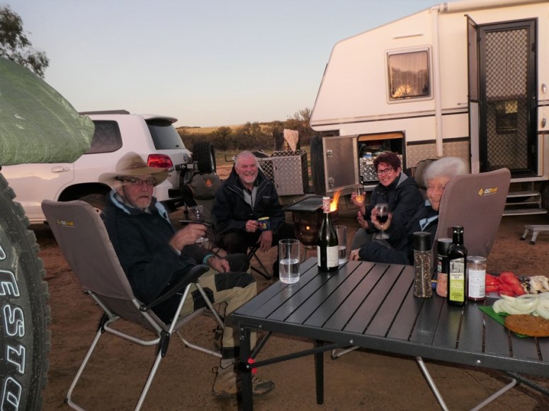
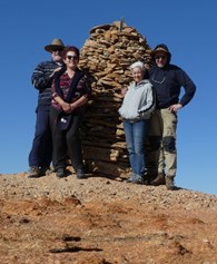
Richard & Marge arrived later in the afternoon and we got settled in and lit a fire, broke out the chairs, opened a bottle and discussed the various journeys to get here and thoughts on the plan for tomorrow.
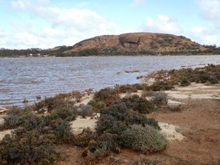
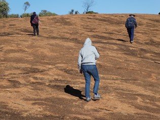
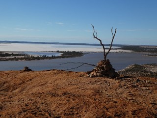
Baladjie is pretty substantial lump of granite with a large lake beside it. Over the next two days we explored the rock and walked around the lake.
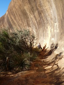
Friday we moved all of 20 minutes down the road to Echingbutting Rock. Another interesting walk across and round one side of the rock but the campsite wasn’t so good and it was even colder at nigh
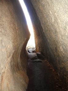
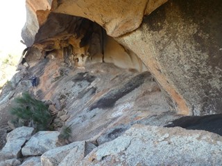
 This is where a large slab has detached from the main
  rock and formed a tunnel some 40m long.
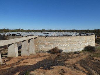
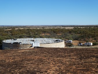
On today to Beringbooding, we’re not stopping the night here but decided to visit as there is a bit of history here. In the early 1930s the farmers were seriously short of water. Eventually it was decided to build a water tank to catch water from the rock. A 2.5 million gallon water tank was build, completed in 1941. Sadly, by this time there was only one farming family left in the immediate area. It was used for a while but then allowed gradually fall into disrepair. It is still used but only crop spraying, etc. as the water is not fit for human consumption.
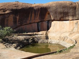
The last picture shows a ‘gnamma’ hole. This is a big one, usually they are much smaller and are found wherever there are dry conditions. They are known to the aborigines who usually block them with rocks to stop wild animals polluting them.
On the way to Mangowine, our next nightstop, we called in at Mukinbudin, another Wheatbelt town that has reinvented itself by tarting up its buildings and has made some attempt at being RV friendly, although currently, with the corona virus that is quite difficult due to social distancing etc.
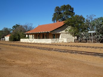 The railway station is on one of the many Wheatbelt grain lines that criss-cross the region.
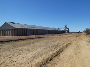
The trains collect the grain from massive grain storage bunds like the one to the right which is in the region of 500m long.
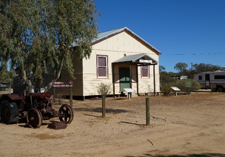 Next stop is another thriving community that seemed to disappear overnight along with the buildings. All that is left is
  Bonnie Rock Community Hall and its guardian.
On then to Mangowine, a stroll round the old homestead and buildings, now belonging to the National Trust, and a look at the family graves before a final trip meal, cooked by Richard on his hotplate and what a good job he did too. Thanks Richard and Marg for your company, we look forward to catching up somewhere out there!