Tuesday 17 July
Today we left Yulara and headed west, I suppose you could say heading home but we do still have a way to go!
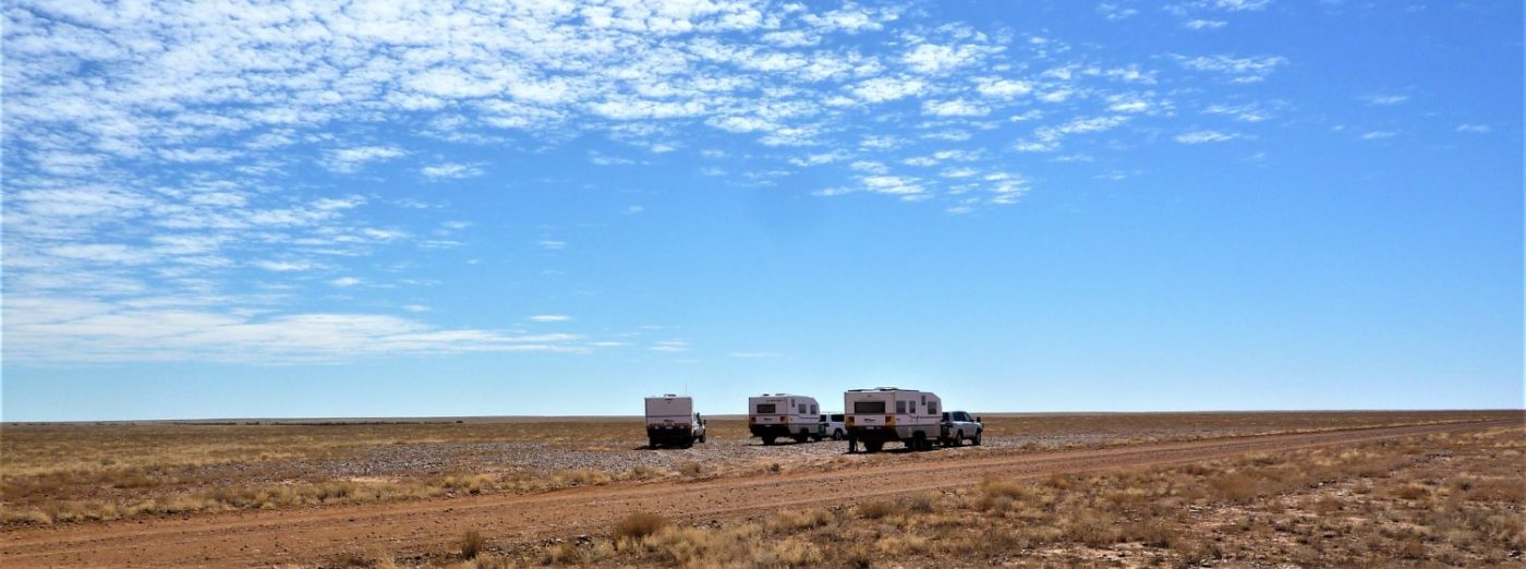
We have a ‘convoy’, a chance conversation with another Bushtracker owner, found they were heading west today as well, so we will travel with them whilst are plans coincide. They are from Sydney are on a trip to visit rellies in Perth.
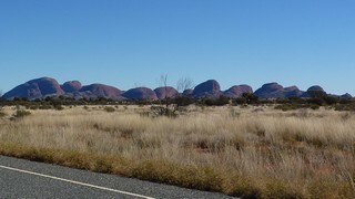
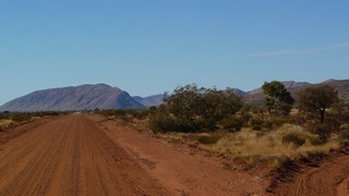
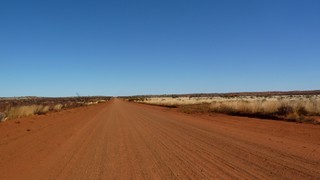
After one last shot of the Olgas, we turn left and west and are immediately back onto a dirt road again, this one as we expected was pretty grotty.
Sure enough, it is grotty and we are down 50 – 60 kph mostly, this is good for the fuel consumption though.
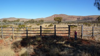
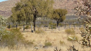
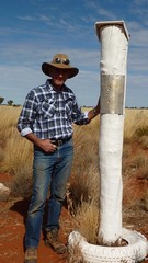
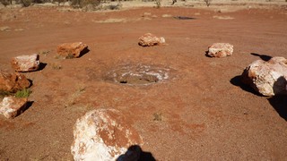
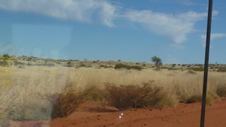
The scenery is magnificent but as usual photographs don’t do it justice. One of the stops along the way is a camel corral that was built about 80 years ago. It is a significant structure (as you can see from the height of Peter in the picture) and about 200 mts in diameter.
The point of interest is Lasseter’s Cave. Harold Lassiter (of Lassiter’s Reef fame) was stranded here after his camels bolted.
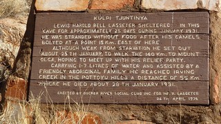
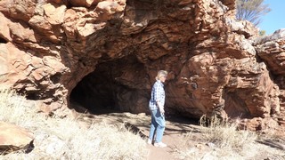
Lassiter was one of the early pioneers of this country and his main claim to fame was that he claimed to have discovered a significant gold reef. The trip referred to on the board was a return trip to try and find the reef.
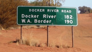
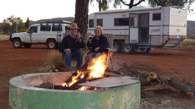
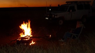
Twenty ks further and we arrive at Docker River (Kaltukatjara) and find a bush campsite just out of the community and set up for the night, collecting firewood for a camp fire.
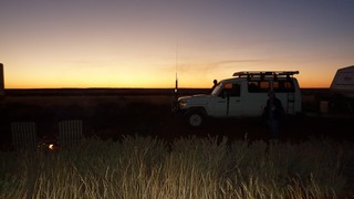
A pre-prandial glass of wine and a fire under a hemisphere of stars – it doesn’t get much better.
Wednesday 18 July
A very lazy start today, on the road by about 1030. Another 8 ks of corrugations before the WA border.
Having crossed the border the road improves dramatically and travelling becomes a more comfortable. Ten minutes later Peter calls up on the radio to say that a police vehicle is approaching and then Lorraine calls up to say they are talking to the policeman. We pull up behind Peter and I walk up to them and guess what – we get breathalysed!!! In the middle of where at 1100 in the morning, that’s twice in a week in the outback! Anyway the cop is a good bloke and we chat with him for while before getting under way again.
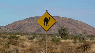
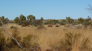
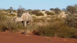
Pat’s been on the lookout for camels because she’d read that if you can’t see them you aren’t looking hard enough! We’ve seen the signs and we’ve seen their tracks but we haven’t seen the camels.
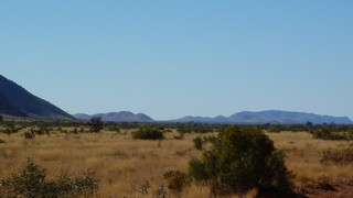
It is beautiful out here, this is the Gibson Desert and these hills are the Peterman Range.
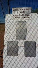
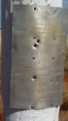 This section of road is the Sandy Blight Jnc road, one of Len Beadell’s roads and we find the point where it joins the Gunbarrel Hwy. He placed markers at strategic points on his road network, these are now replica plates as a few got souvenired and all the remaining originals have now been removed for safe keeping. This is a good spot so we decide to stop here for lunch.
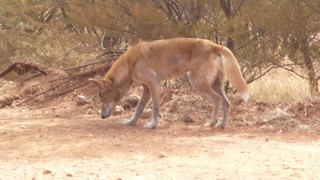
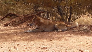
Pushing on a local dingo decides to cross the road to find some shade…………
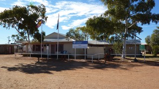
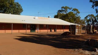
We now follow the Gunbarrel fo another 15 ks and then turn off to Warakurna Roadhouse where we will probably stay on the campsite tonight. A few ks up the road is the Giles Meterological Station, named in honour of one of the early Europeans who explored this area. The weather station was established in 1957 after road access was made possible through Len Beadell’s Gunbarrel Hwy. The weather station is manned by three meteorologists and support staff.
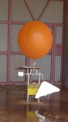
They launch weather balloons three times a day and we timed our visit to be able to witness a launch as part of a guided tour of the station.
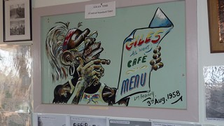
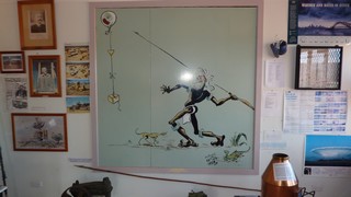
Len Beadell came here often and his cartoons adorn the mess walls.
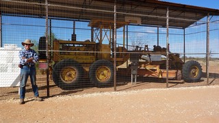
The grader that The Gunbarrel Construction Co used to make 6000 ks of roads in remote Central Australia has been preserved here as are some of the original marker plates.
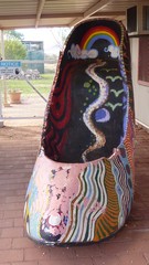
This shoe was perched on top of the bus in the film ‘Priscilla – Queen of the Desert’. Apparently it was dumped in the desert and found its way into an aboriginal community, where they proceeded to paint it. Then the local police decided that Giles weather station should have it – they’ve been trying to persuade someone to take it away ever since!
Saturday 21 July
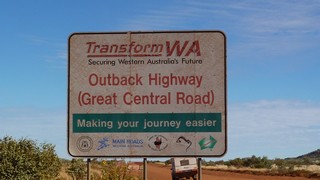
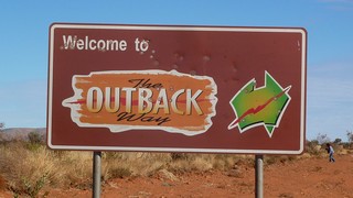
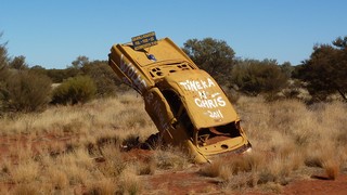
For the last five days we have been travelling the Great Central Road from Uluru to Laverton, approximately 1100 ks of dirt road (apart from about 13 ks west of Warburton). The road surface has varied from very corrugated to highway standard, we have been averaging 60kph, whilst most traffic is travelling at 80–90 ks but some vehicles have been doing well over 100kph and making no attempt to slow down when they are passing other vehicles, these are usually our indigenous friends who just flog vehicles to death, strip anything useful of them and leave them beside the road, we have seen literally hundreds this week.
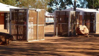
We needed permits to transit the aboriginal lands in the Gibson and Great Victorian Deserts. These are very spefic in what you can do and where you can go. Theoretically we are not allowed to take alcohol into the lands but we keep it discretely in the caravan (some places you are banned from consuming alcohol). The fuel stops are usually close to aboriginal communities and generally you are not allowed to take photographs. The one exception was Warakurna (above). Note the fuel pumps are in locked cages!
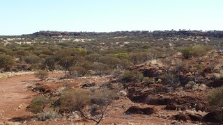
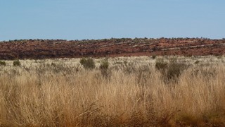
We have been travelling mostly through the Gibson Desert, although the last 200 ks into Laverton are in the northern part of the Great Victoria Desert (GVD). Although from the pictures it doesn’t look like the archetypal desert (with bands of Tauregs coming over the sand dunes!), deserts are defined by rainfall (< 250 mm of sporadic rain per year) and these areas get minimal rainfall. The gibson is characterised by sand dunes (average height 10m), covered in spinifex and short shrubs. The GVD has rock outcrops rather than sand dunes and there is less spinifex and more taller shrubs.
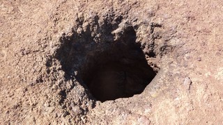
The days have been composed of some really hard driving at times, looking at the rockholes (waterholes) along the route (only one had water in it). Historically these were important to the aboriginals, as their only source of water.
Water pumps (windmills), are important to the pastoralists for watering stock, the pump part of the system can be switched off when you want to move the cattle to another paddock.
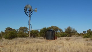
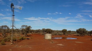
Apparently cattle can smell water over significant distances, so one farmer recently set up all his bore pumps to operate on solar energy. Now, when he wants to move his herd, he switches off the pump at one location and switches another on ina another paddock. The water runs out in the first paddock, the cattle smell the new water and head off into the next paddock! The farmer does all this from his computer, saving considerable time and money in having to go out manage the stock!
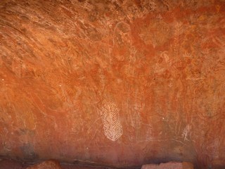
The aboriginals lived in caves and moved from water supply to water supply, many of their caves contain paintings. Interestingly, the northern aboriginal paintings are more sophisticated than the desert aboriginals because life was extremely hard in the desert and most of their time and energy was spent surviving. whereas the northern aboriginals had more plentiful food and water, so they had more time to paint and carve.

The ‘book’ said, if you don’t see any camels you’re not looking hard enough! Pat had been looking but hadn’t seen any – so it came as a great relief for her to spot a mob off the left of the road.
The scenery throughout this part of the trip has been vast and awesome…. I’ll say no more!
In the afternoons we have been selecting somewhere to camp for the night, collecting firewood and lighting camp fires, witnessing beautiful desert sunsets, looking up a complete hemisphere of more stars than we have ever seen before and waking up to wonderful desert sunrises.
So we are now at Laverton and ‘civilisation’, still about ten days and a few hundred ks to go but the experience of the last few days will stay with us for ever, or until we come back this way again, which will hopefully be soon.
