Wednesday 24th April
The highlight today was the 40ks of sealed road about 60ks west of Warburton. There is a plan to seal the Great Central all the way from Laverton to Yulara but it is a massive undertaking, 1100 ks of some very remote road. We have travelled 560 ks from Laverton to get to Warburton (a large aboriginal community) with nothing but desert in between. Then there’s another 600 to Yulara with only two small aboriginal communities in between, so all the road building equipment, including hot mix plants need to be brought out into these areas. There is also a limited window of operations as it is far too hot in the summer and or too wet which makes access very difficult.
We need to stop at Warburton to get some milk (UHT of course) and had planned to get fuel at Warakurna, 235 ks further on but we are advised at Warburton that Warakurna has run out of diesel, so we fill up here instead. It is also reasonably cheap here at $2.27 a litre!
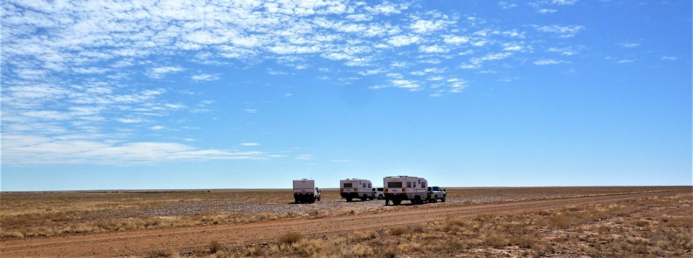
We also change from WST to Central time (+1.5 hours) so we have an early finish to the travelling. We find a good spot well off the road and get a fire going, unfortunately this doesn’t deter the flies!
 These aren’t posed! No satelli
 tes last night but we’re in a different time zone so………?
Thursday 24th April
An odd start today it didn’t get light until gone 0730 so we were a bit disorientated and it was 0945 Central Time when we got under way, nearly time for morning tea!
The only real problem today is the wind again, which is putting our fuel consumption up, on top of this the road conditions have deteriorated which doesn’t help fuel usage either. Soon it really is time for morning tea and we pull off the road at Yala Kutjarr, which is a camp site about 200m off the road.
There are some information boards and the remnants of an old piece of roadworking equipment which seems to have fewer and fewer bits left every time we pass this way, that’s the dunny in the background!


Afternoon tea is taken at another spot we have visited before, Giles River, although the river bed shows no sign of the rain they had through here a month ago.
The scenery is beautiful and the wind through the desert oaks is magic. Back on the road we approach the border the ranges which stand out in the afternoon sun, breathtaking!
At the border we are leaving WA and have done 1841 ks since Karnup. The border is pretty innocuous just a few signs BUT there are about 15ks of sealed road sealed road here now! However, we know it doesn’t continue far the other side of the community of Docker River. Tonight we’re camping just outside Docker River, we’ve been here before, it is a lovely area amongst the desert oaks. One satellite tonight.
Friday 26th April
We know that the road gets worse from here on to Kata Tjuta (the Olga’s), it is appalling sometimes we’re down to 15 kph! It is dire, quite badly corregated.
We pull off the track for lunch and bit of relief from the corrugations. This place is another that we have visited before but this time our ‘indigenous friends’ had been here!


 This is very, very common across the GCR, wrecked cars and rubbish strewn everywhere. Many of the cars have been torched, they do this so that the community, which maybe many ks away, see the black smoke and know that someone needs picking up! The rubbish is created while they wait!
These are the people who are constantly telling us to respect their culture!
After a pretty bumpy ride we suddenly come onto the tar and a few ks later we arrive in the area where we found our ‘Olga’s View’ camp site two years ago. The area is unrecognisable, the road gangs have, of necessity I guess, flattened everything and we cannot find anywhere to get into the bush. We decide to push on a bit and on the opposite of the road we find a site just as good as the previous one with plenty of firewood.

 The scene changes as the sun gets lower.

 An interesting cloud formation. Four satellites tonight!
Saturday 27th April
Today were on the tar and heading for the Alice but with a strong headwind we used a lot of fuel getting to Erldunda on the Stuart Hwy, the main north south road from Adelaide to Darwin. Brad was due to pick up fuel here but we had been told that there was water in it by some travellers we met at Curtin Springs, where we had stopped for lunch, so he decided to put some in there and then. None of the road houses on this part of the trip have any telstra signal nor WiFi. After a coffee at Erldunda we headed up the Hwy to Stuart Well, another 100ks up the road. This is mainly a stop for road trains but there is a free campsite by the side. There’s no-one else staying here so we get to choose a spot for the night. A Thai Curry at the roadhouse and an early night! Definitely no satellites.
Sunday 28th April
A short run (90ks) up to Alice this morning no roadtrains coming up from behind so a nice easy drive. We have been booked in at the caravan park so no problems, although the sites are quite small and there are trees which are a bit of a problem. Some people like the shade. No chance for the satellite dish and a bit of pruning to get the awning out!
Having got established we head off to the Botanic Gardens for lunch which is very pleasant. This was followed by a trip to Bunnings to stock up on a few bits and pieces. Alice Springs is a busy place and there is a lot of money here, it is in a very strategic position mostly north of ‘the gap’ in the McDonnell Ranges, discovered by John Stuart on his expedition from Adelaide to the north coast of Australia.


‘The Gap’ is no more than about 300 metres wide at ground level and has the Todd River, the main road and the railway line all running through it. It is quite difficult to photograph and give the right impression but I’ll try to get some DashCam footage tomorrow. It would be good to get a train going through but I can’t guarantee that.
https://1drv.ms/v/s!AksnrQT2cvoG3EpsCUJvXCaGYmtV
I have some aluminium welding which needs doing but I can’t organise that until tomorrow so it’s a bit of pottering around the van and the cruiser until wine o’clock.
Monday and Tuesday
Have been spent stocking up with food and making freezer packs with it. My aluminium welding was done yesterday so the caravan stone guard has been refitted. I’ve done some maintenance on both the van and the car so we should be OK for a bit longer.
Australia Post have lost Brad’s replacement water pump for the caravan so we have had to stay another day. Since the last two days have been pretty busy, a day of rest will be nice.
Wednesday 1st May
The pump has miraculously been found this morning, so hopefully we’ll get it fitted today and get away tomorrow.
Here is the best I can do for a map of our progress at the moment, I have a new navigation system and am only the scratching the surface of it’s capability at the moment!

There appear to be lots of lines on it but our course hasn’t really been that erratic! They are the planned route options from Karnup to Alice you can see the route followed and the flags show the night stops. It’s probably good to see these as in this particular case our intention was to follow the purple track out of Alice on the Sandover Hwy, unfortunately that road is closed due to flooding! The blue route would have been the Plenty Hwy that we have been on before but that too is closed!
So tomorrow we will head up the Stuart Hwy to Tennant Creek and then head east on the Barkly Hwy, which disappointingly is all tar! Never mind there’s always another time.
