On Saturday 26th May we set out on our longest yet journey by caravan, the plan is to head for Adelaide, arriving on Friday 1st June, where we meet up with some Adelaide ringers, plus Adam and Corinne from Perth and Doug from Hobart. We will all leave Adelaide on Saturday and work our way up through the Riverina (Victoria and New South Wales) through the Blue Mountains, then back down to Sydney for the 50th ANZAB AGM. After a week or so in Sydney we will set off again heading in the general direction of WA, via Mungo NP, Menindi Lakes and Broken Hill (NSW), then across to the northern Flinders Ranges, Maree (at the bottom of the famous Birdsville Track), William Creek, Lake Eyre and Oodanadatta in South Australia, before turning west to Uluru (Ayres Rock) and the Great Central Road through the Northern Territory back into Western Australia, Laverton, Kalgoorlie and home!
Well, that’s the plan!
We didn’t do too badly and left Karnup at 0900, an understandable hour later than planned, due to lots of ‘last minute’ tasks. It’s interesting that when we went up north two years ago for a similar period, we were both working and we got everything done in a few days, this time we had weeks and still had a last two week rush! We made it to Hyden ( the home of Wave Rock) just after 3.00pm having traveled 375ks, which isn’t much but there’s a lot of hill work to get over the Darling Ranges and with a 6,700 kg rig it takes a bit of time. We had discussed pushing on a bit further but after Hyden it’s dirt for 300 ks to Norseman and by the time we had stopped and dropped the tyre pressures it would be getting late and we don’t travel at dawn or dusk to avoid unscheduled meetings with the wildlife! Wave Rock is worth a visit, in fact it is on what we laughingly call our ‘reli route’, ie; any of our visitors who fancy, or have time for, a trip out into the back blocks, get a visit to it on the way to Esperence in the south or Kalgoorlie to the north.
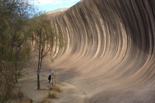
The colours in the rock are generated by the minerals in the water that has run over the edge for thousands of years. Unfortunately, the Rock has now had a concrete stub wall built round the top edge to direct water into a dam – we can only speculate on how this will affect the colouration of the Rock in the future.
Sunday 27th May
We’re getting better, only half an hour late this morning and we were on the road at 0830, leaving Hyden in a thick mist, windscreen wipers on and less than 100 metres visability, this is different! The Hyden – Norseman Road is mostly dirt but often dirt roads are better than their sealed equivalents. There are several mines along this road so it tends to get graded fairly frequently. Today we find it in pretty good nick as far as the Lounge Lizard and Flying Fox mines after which the corrugations got a little worse but having just commented to Pat that “the grader must have been through pretty recently” we saw him in the distance. We slowed down and had a chat on UHF as we went past. These guys work on their own with their graders, this one was half way between Hyden and Norseman, ie; 150 ks from any sort of habitation, a lonely task but very important. Passing Maggie Hays mine the road improved significantly but it had been watered (to keep the dust down), which made it a bit slippery and potentially dodgy if you get a wiggle on with the van. Soon we reached the head of Lake Johnson where there is an area for camping and a ‘long drop’ loo, so we stopped for a leak and a leg stretch.
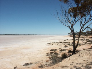 Lake Johnson is one of many salt lakes that litter WA, this one stretches for around 80 ks to the south. We actually cross a narrow neck of land between this and a whole series of small salt lakes to the north. From here it’s a straight run into Norseman passing Disappointment Rock, worth a climb, with 360 views from the top. Last time I was here, we came back down to find the lights on on the troopie! This is when twin batteries are useful but as soon as we got back, we had a warning fitted, it’s an 80k walk into Norseman!
Refuel, pump the tyres up again and have some lunch before setting out for Balladonia, our night stop. This is a comfortable 180 ks on the Eyre Hwy mostly straight with few hills so it’s comfortable sitting on cruise at around 95 kph, fuel consumption around 18 l/100k. The highway takes us through the Fraser Range about half way, the scenery is good but difficult to photograph.
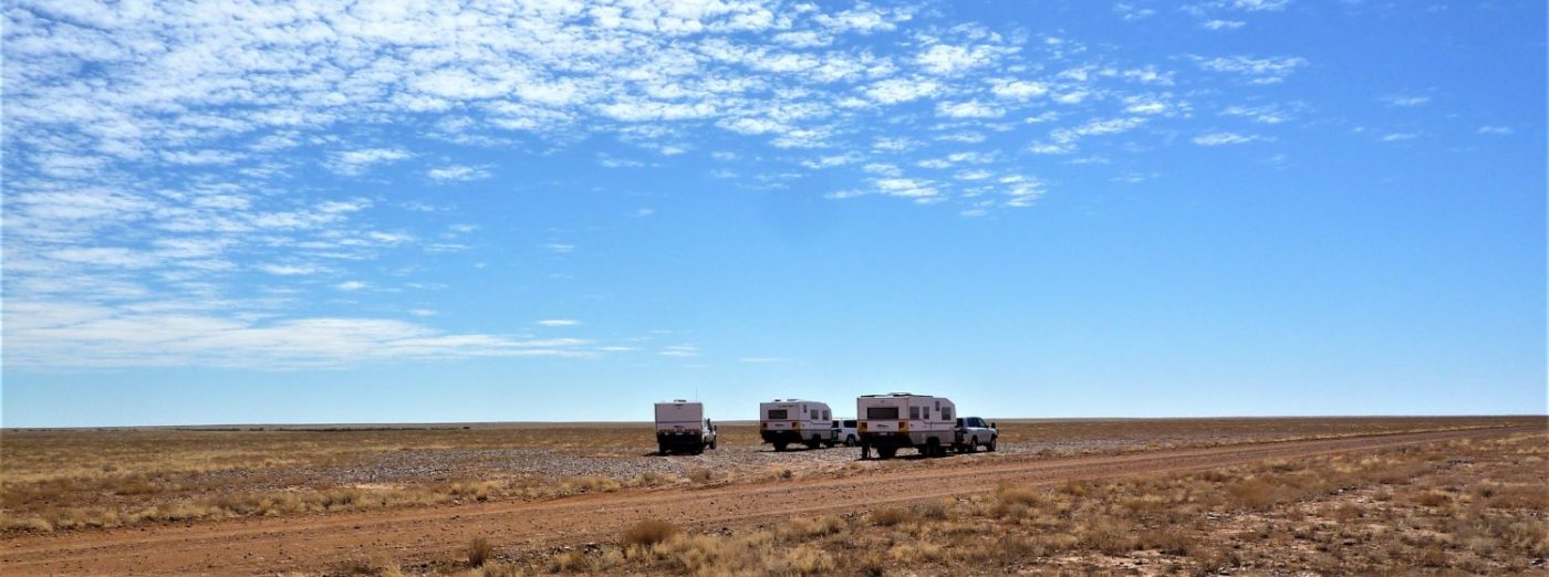
Reached Balladonia just after three, sign in, just park where you like and plug in! This is just a dirt football pitch where most people would just be night stopping so no need for anything spectacular, in any event there’s no water for grass!
Monday 28th May
Well done us, only 20 minutes behind schedule this morning!
Our target today is Eucla, a few ks from the South Australia border. We are expecting a good run today as it is all straight and fairly flat, fingers crossed that the winds are fair and not in our face. Although people say that Balladonia is the start of the Nullabor plain, in fact, it is really the Nullabor Tablelands, averaging around a 100′ above sea level there is about 300 ks of it before we reach Madura.
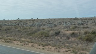 The landscape is impressive both in size and emptiness, it makes you feel small and ‘out there’, even though there is traffic heading west at regular intervals. An interesting (explainable) phenomena works here. We have travelled over 500 ks since we left Norseman and only once have we had a vehicle behind us and that was a truck that overtook us just before Cocklebiddy Roadhouse.
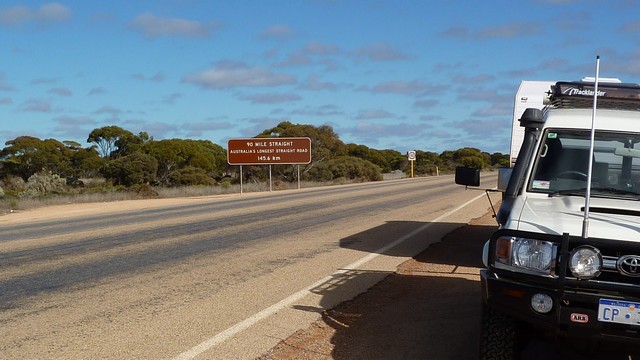
About 50 ks out of Balladonia, we hit the 90 mile straight, this section of the Eyre Hwy is literally straight for 146 ks, there are few changes in level, so sometimes the headlights of a vehicle can be seen in the distance that appear to be in the sky, it comes over a rise several ks away.
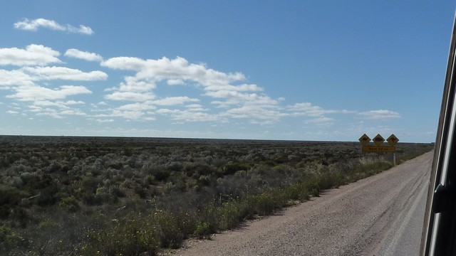
 Sections of this road are also used by RFDS (Royal Flying Doctor Service) as emergency airstrips. Generally the bush is cleared for 10 metres or so beside the road to allow for wingspan and turning. The standard ‘piano keys’ are painted on the road and as you can see we are ready for take-off!


At Madura Pass, we drop down off the Tablelands to the Nullabor Plain proper.


From here to the Eucla (200 ks) we are running along the bottom of the scarp, which is quite an impressive feature, rising as it does very steeply from the plain.


We arrive at Eucla Pass which takes the Hwy back up onto the tablelands. We had chosen to stay here at the campsite on the recommendation of a camping guide but having driven into the car park, parked the rig and enquired we were told that the caravan park was closed for maintenance!!
Fortunately, in this instance the State border is just down the road and another park, definitely not as salubrious as the one at Eucla but there you go.
A good run today 522 ks and interesting scenery, albeit a lot of it!
After 3 days and 1350 ks we finally leave WA and enter SA, if only for a 100 metres before turning into the caravan park at Border village!
Tuesday 29th May
A wedding anniversary day on the road. We’re aiming to get through to Ceduna, 479 ks, so that we can go out to dinner. This part of the Nullabor lives up to it’s name ie; no trees, the shrubs are no more than a metre high! There another 300 ks of this into Ceduna. There are several places where you can turn off the highway and go down to have a look at the Southern Ocean, where the cliffs are pretty spectacular.


There is the Nullabor golf course (9 holes) with the first tee at Balladonia and the last one at Ceduna, this one is at the Nullabor Roadhouse and is called the Dingo’s Den. The holes are normal length but of course the tees are approximately 100 ks apart!
The sign below says beware of Camels, Wombats and Roos for the next 190ks.


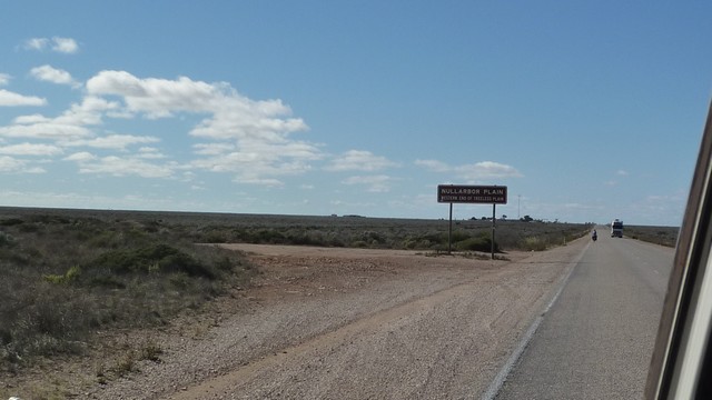
The last part of the Plain is truly ‘nullabor’ and runs for a 100ks before the road rises up back onto the tablelands. The sign below notes the official end of the Nullabor. Check out the guy on the push bike. The husband of a colleague of Pat cycled from Perth to Sydney for charity!
The last 100 ks into Ceduna are quite different, the scenery changes to fairly dense scrub and low trees, which have a lot of green in them, the road undulates which makes it more interesting, ie; you can’t see more than 10 -20ks ahead, so it’s more exciting!
We made Ceduna by 3:30 including a 1.5 hour time zone change.
Tonight a celebration dinner in the Ceduna Foreshore restaurant, a very nice seafood platter and a bottle semillon sauvignon blanc, with a stroll along the jetty afterwards. A great way to end the day.

Have a good trip Brian & Pete